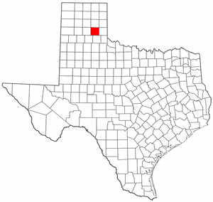
Donley County
- Coordinates
- 34° 57' 36" N, 100° 48' 36" W (34.96, -100.81)
- State
- Texas
- Region
- Panhandle
- County Seat:
- Clarendon
- Year Organized:
- 1876
- Total Square Miles:
-
933.046
- Population:
-
3311 (2017)
- Persons/Square Mile:
- 4
- Donley County Website
- http://www.co.donley.tx.us/
Contiguous Counties
Gray (N)Collingsworth (E)
Hall (S)
Briscoe (SW)
Armstrong (W)
Wheeler (NW)
Donley County Offices
County structure
- Government Type:
- County
- Authority:
- Dillon's Rule
- Legislative Body:
- Commisioners Court
- Size of Legislative Body:
- 5
Demographics
- 2018 Population:
- 3311
- 25 to 64 Years of Age:
- 42.75%
- 65 Years of Age and Older:
- 23.98%
Economy, 2018
- Gross Domestic Product (GDP):
- $162.8 M
- Labor Force:
- 1,574
- Unemployment Rate:
- 3.40%
The Texas Legislature established Donley County, Texas, in 1876. The county was later re-organized in 1882. It is found in the southeast quadrant of Texas. Its county seat is Clarendon, found in the southeast of Amarillo, and has a population of 949.
Donley county was named for Stockton P. Donley, a confederate veteran, also the Texas Supreme Court Justice. The county has a population of 3,258. Donley county has an area coverage of 900 square miles.
Donley County Economic Structure
The economic structure of Donley county is mainly composed of agribusiness activities. The agricultural sector has farming activities, with wheat, cotton, hay, and peanuts as the primary crops grown. Other economic activities carried out in the county are tourism and manufacturing activities. Donley county irrigates up to 11,000 acres of its land to sustain agriculture.
Donley County Offices
The county has several county offices established to serve the county’s best interest and deliver services to the public.
The county attorney is Landon Lambert, whom you can contact by phone at (806) 874-1847 or fax at (806) 874-1847. Among his roles is criminal activities investigation, hearing and ruling misdemeanor offense charges, and advising the county commissioner court on legal matters.
The county sheriff’s office is under Sheriff Charles Blackburn. You can contact him by phone at (806) 874-3533 or fax at (806) 874-3458. This office is responsible for maintaining traffic safety, investigating criminal activities, resolving disputes, and responding to emergency calls.
The county tax assessor/collector office is another important office. Kristy Christopher heads the office. You can contact him by phone at (806) 874-2193 or fax at (806) 874-3165.
Donley County Towns
Donley county’s significant towns include Clarendon, Howardwick, Lelia Lake, and Hedley. Across the counties, there are 2,161 housing units, with 70.3% being owner-occupied units. Given that there are 1,335 households and 2.27 persons per housing, this number of housing units across the counties is enough for the population.
The towns have well-serviced roads making transport efficient. They also have enhanced security protocols for the safety of the public. Various industries, primarily light manufacturing, spread across the towns, offering job opportunities to its residents.
Financial Transparency
Donley County, Texas, is among the Texas counties that make their financial status public. By this, the county residents and employees gain access to the county’s budget, revenues, expenses, and financial data history.
The county provides the treasury report, utility reports, check registers, tax rates, budgets, and proposed budgets.
- Utility reports- The county’s utility report shows services, mostly underground services like water piping, gas, communication systems, and electricity. This report is compiled after every month. The report shows the usage and cost of the utilities for every county facility.
- Budgets- the county budget shows how the administration spent and plans to spend on the upcoming fiscal year. The expenses include what is spent on public goods and the delivery of public services. It also includes government investment, like research and infrastructure development.
- Tax Rate- Through the tax assessor/collector office, the county government updates and provides information about the year’s tax rates. If there is an increase in the tax rate, the county will notify the public via the report.
- Check registers- the county’s check register shows the record of each county agency’s expenses and incoming revenues.
- Treasurer’s Report- The treasurer’s report assesses the tax dollar transactions. It records all the revenues the county received through taxes and other means. It also records how the money was distributed to the various county agencies.
- Proposed Budgets – Donley county avails the proposed county budget to the public before the official budget is drafted. The proposed budget shows the proposed tax rates and the officials’ proposed salary.
Donley County Attraction Sites
The county has many attraction sites, including parks, historic sites, religious sites, landmarks, and unique architecture. Its lifestyle and cultural practices are also unique, thus attracting tourists.
Historical sites in the county include the Courthouse, Palo Duro Canyon State Park, Saints Roost Museum, and Clarendon College. Religious sites include the First Baptist Church, First Christian Church, and Calvary Baptist Church.
Attraction parks include Wonderland park, Palo Duro Canyon State Park, and Amarillo Zoo.
The 501 Winery, Pondaseta brewing, Pheasant Ridge Winery, and the Cowgirls and Cowboys in the West are traditional and cultural practices that serve as attractions to the county.
Donley County Physical Features
Plains and small hills dominate Donley county’s physical features. In between the hills are valleys of varied sizes. Soils in the county vary from black waxy to dark gray soil. This soil is ideal for farming activities. Some areas of the county are also covered with sandy and clay soils.
Natural forests are not dominant; they are scattered. However, the county is home to plantations of planted forests.
Notable water bodies are rivers, a lake, streams, and springs. The Red River runs from eastwards of the county, Lelia Lake, covering 200 acres. Other water bodies include springs and streams.
The climatic conditions of significant parts of the county favor ranching activities. Some areas with sufficient rainfall and favorable conditions support growing crops. Wheat, corn, cotton, sorghum, potatoes, melons, millets, and fruits are grown.
Donley County Demographics
The United States Census Bureau indicates that Donley county has a population of 3,258 in 2020. The population of the county was 3,677 in 2010. The dependency ratio of the county is high, with 24.5% of the population being individuals aged 65 years and more. Individuals below 18 years, who are also a dependent group, constitute 19.4% of the population.
The whites alone are the dominant settlers in Donley county, with 90.7% of the population. The Pacific Islanders, including the native Hawaiian, have the least composition with 0.1% of the population.
There are 1,335 households in Donley county. The average number of persons per household is 2.27 persons. The number of housing units is 2,161, with a median gross rent of $664.
56.2% of the population have formal employment in civilian institutions. Household income registered a median of $42, 961. The poverty rate in the county is 16.4%.
Conclusion
Donley county is a safe place to live in. The county is also sustainable, with average job opportunities supported by affordable and available accommodation facilities. Various attraction sites in Donley county make it a tourism hub.